Errata, 50k, Examples
This is part of the Error Metadata for RRGIS Repository
mhw *
27 April, 2001
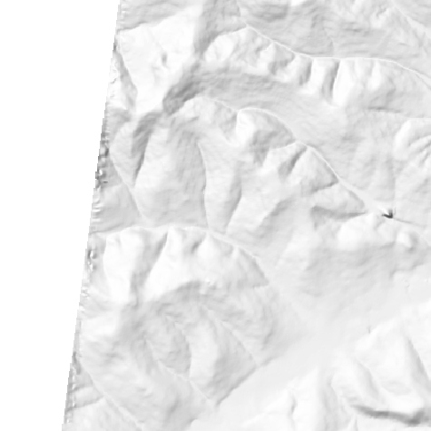
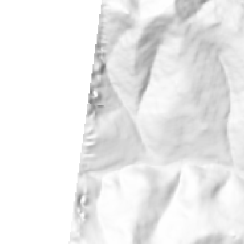
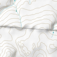
This document shows examples of the types of errors in the RRGIS Spatial
Data Repository discovered with the aid of shaded relief images generated
from 1:50k NTDB contours and watercourses. See the Errata
50k package downloadable from the RRGIS
website for explicit point by point references to specific problems. The
images here are all screen shots taken from the Errata_50k ArcView
project before the errors were corrected. I regret not beginning this example
document earlier because the most egregious and visually interesting errors
are already fixed.
-matt
Source Data Errors
These are errors in the actual base data itself. The most common forms are:
- edge mismatch along tile borders
- watercourses draining into more than one watershed
- features on the wrong data layer, for example a treeline vector is coded
as a watercourse.
- contours with wrong elevation values
Process Errors
These errors result from pushing either the data or the interpolation tools
beyond their capabilities. Sometimes this can be fixed by slightly altering
the data. Other times you just have to live with it.
- watercourses with the wrong flow direction (they run uphill)
- spurious ridges and wave forms in the surface. These usually occur in broad
flat areas where there are not enough data points
Anti-Errors
These are anomalies which appear to reflect a problem with the data or the
software but turn out to be faithful representations of the source data. Please
keep in mind that a feature can be an accurate reflection of the source data
and still be very wrong since there is no guarantee the source data itself is
correct.
On to the Examples
Source Data Errors
Uncorrectable edge effect.
Each tile is internally consistant so there is nothing to change. The source
data for these two tiles were captured at slightly different scales. Short
of going back to the original photos for a reinterpretation there is nothing
to be done.
Edge effect due to lack of data. If we desire a 'perfect' DEM our only option
would be to make the area of interest smaller. The image on the left also
shows a second source data error.


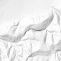
Correctable edge effect
In the northern-most tile, halfway down the slope the elevations start to
rise again. When compared with the adjacent tile to the south it is obvious
the elevations should just continue smoothly downward.

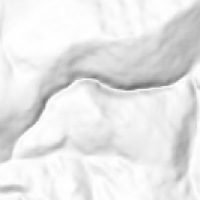
A second example of correctible edge effect. This time it is the southern
tile whose elevation values switch direction mid-slope. The image on the right
shows two contours selected in yellow and the database attributes of those
selected contours at the bottom where it is apparent these two contours diverge
by almost 200 meters (you will have to click through to the full resolution
image to read the text).

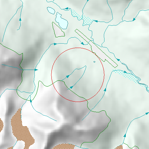
Double watershed streams
These errors can be a little tricky, for in nature it is possible for two watersheds
to be joined by single stream which in effect flows both ways. However most
of the double watershed streams we found in the Repository are data topological
errors and not likely to be the real thing.
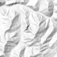
This double watershed stream stands a pretty good chance of being the real
thing. There is probably a marshy area in the middle of the saddle but only
higher resolution photos or a ground truth expedition will let us know for
sure. The simple fix is too break the vector into two so the flow direction
can be correct for each watershed.

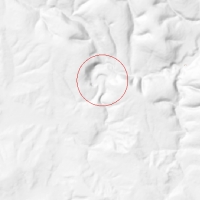
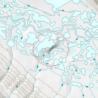
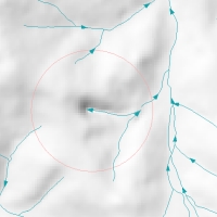
Another double watershed stream. This is one of the few shaded relief anomalies
where zooming out rather than in is necessary to understand what is happening.

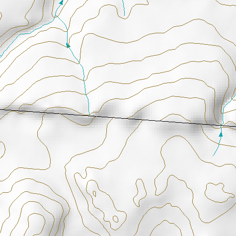
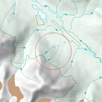
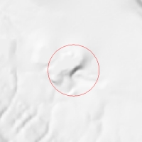
Stream crosses mountain
At first glance this appears to be similar to the double watershed examples
above.
With a closer look it is apparent this watercourse does not conform to the
topography at all.

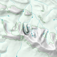
It's hard to figure out what's going on here until we turn on the forest
cover layer. Obviously this watercourse is an imposter and now we know it's
true identity.
The contour and watercourse lines cross each other. This kind of error is
rare with this example being the only one of this type discovered in the base
data, so far.


There is an elevation line grossly out of step with it's neighbours. In this
case it was a lake shoreline more than 200 meters higher than it should have
been.
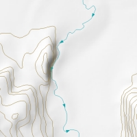
These two streams just stop in the middle of nowhere. Either they should
be coded as 'disappearing stream' or there is a marsh or waterbody missing
from the dataset. The shaded relief images only played an incidental role
in discovering this error, I just happened to see it while looking for problems
with the relief.
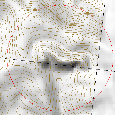
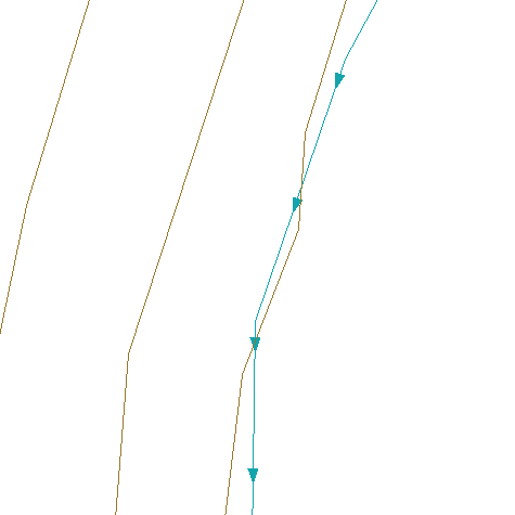
Another anti-gravity watercourse

Truly the Grandaddy of anti-gravity streams. Even with the forest cover layer
turned on it's hard to figure out what is supposed to be happening here.

Process errors
These are errors resulting from the way DEM generation works. The software
simply cannot deal effectively with certain arrangements of data and there is
nothing which can be done about it without creating fake data to guide the interpolation.


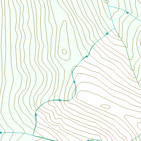
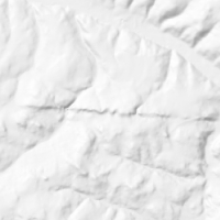
A second example of interpolated artifacting. There is simply not enough
nearby elevation data.
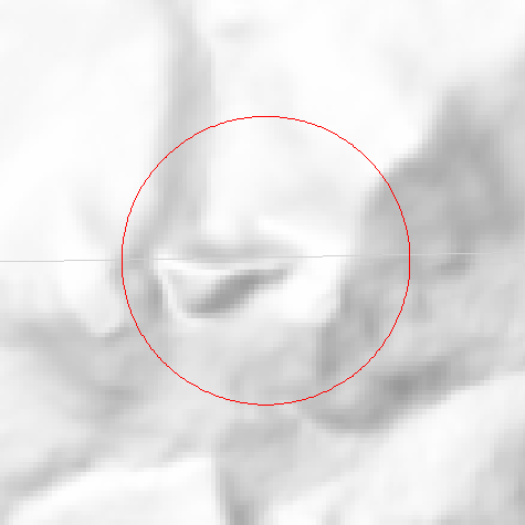
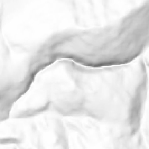
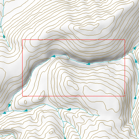
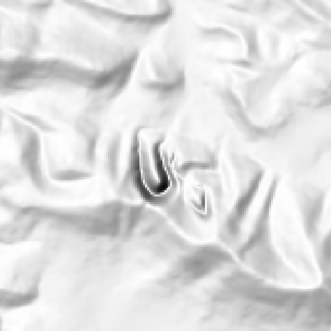
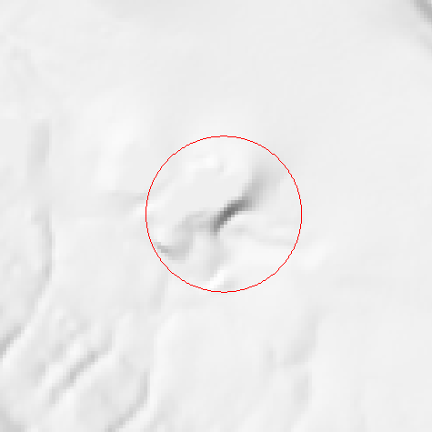
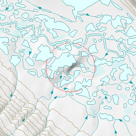
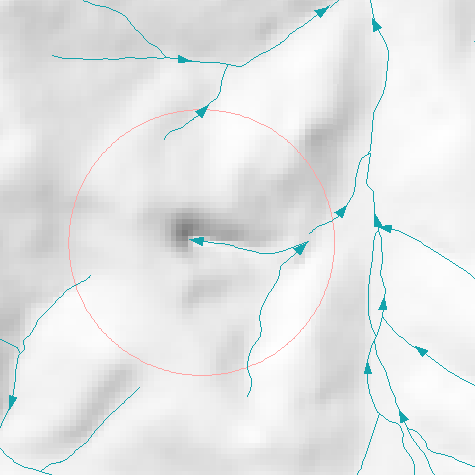
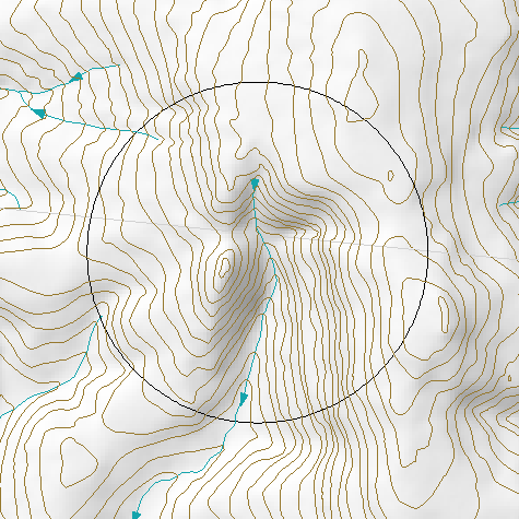
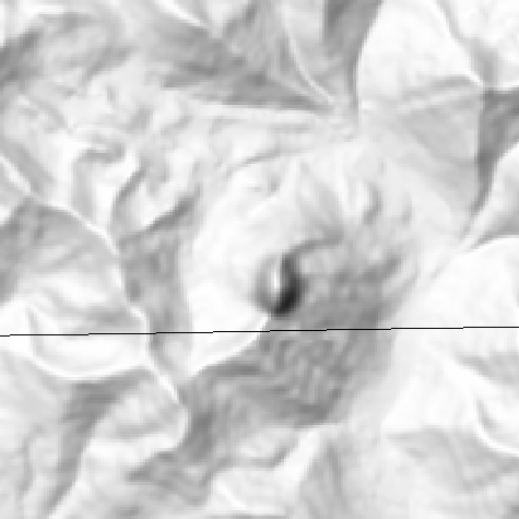
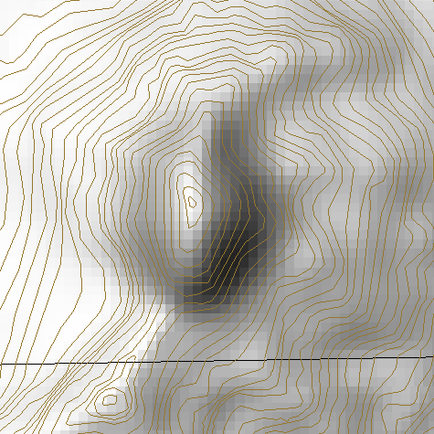
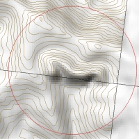
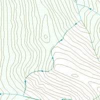
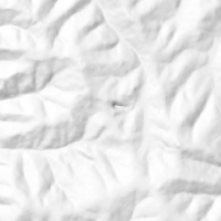
Box canyon anomaly. This very common error is created from streams which
are pointing in the wrong direction (uphill) and drainage enforcement is being
used in the DEM creation process. This can not be considered an error in the
base data since flow direction is not part of the NTDB specification for watercourses.
Source data errors
Anti-Errors
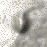
Looking at the shaded relief and the tile border line it looks like there
is some edge effect, however a closer look reveals that the shaded relief accurately
reflects the source data.
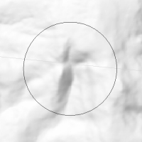
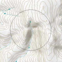
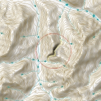
This pimple turns out to be supported by the source data, it is simply a very
sharp peak.

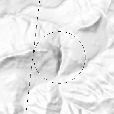
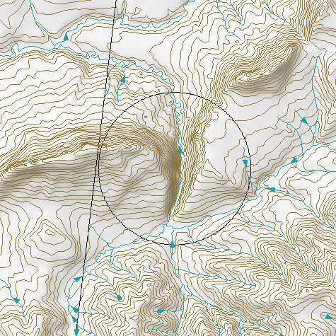
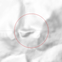
A canyon anomaly which has the potential of being an imposter watercourse.
The anomaly turns out to be supported by the base data.


Last Update:
April 27, 2001
* mhw
© 1999-2001 Yukon Renewable Resources